The Kansas Pacific Railway (KP) was a historic railroad company that operated in the western United States in the late 19th century. It was a federally chartered railroad, backed with government land grants. At a time when the first transcontinental railroad was being constructed by the Central Pacific and the Union Pacific, it tried and failed to join the transcontinental ranks.
It was originally the “Union Pacific, Eastern Division”, although it was completely independent. The Pennsylvania Railroad, working with Missouri financiers, designed it as a feeder line to the transcontinental system. The owners lobbied heavily in Washington for money to build a railroad from Kansas City to Colorado, and then to California. It failed to get funding to go west of Colorado.
It operated many of the first long-distance lines in the state of Kansas in the 1870s, extending the national railway network westward across that state and into Colorado. Its main line furnished a principal transportation route that opened up settlement of the central Great Plains, and its link from Kansas City to Denver provided the last link in the coast-to-coast railway network in 1870. The railroad was consolidated with the Union Pacific in 1880, and its mainline continues to be an integral part of the Union Pacific network today.
Here below is a set of amazing photos of ‘Across the Continent on the Kansas Pacific Railroad’ in 1867.
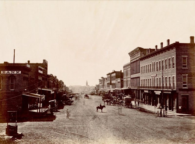 |
| Massachusetts Avenue, Lawrence, Kansas, 38 miles West of Missouri River, circa 1867 |
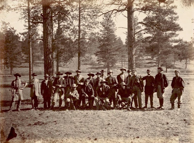 |
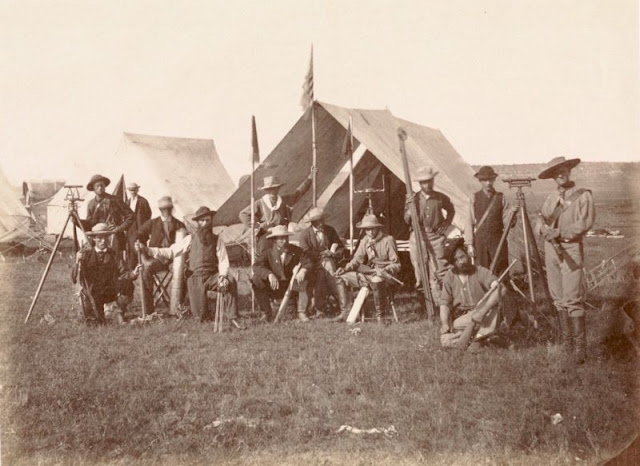
| 2d Division of Engineer Corps, in the Sierra Madre, New Mexico, (Water Shed of Continent), 1,000 miles west of Missouri River, November 1867 |
 |
| At Fort Mojave, on the Colorado River, 1,450 miles west of Missouri River, circa 1867 |
 |
| Banks of the Kaw, near Fort Riley, 135 miles west of Missouri River, 1867 |
 |
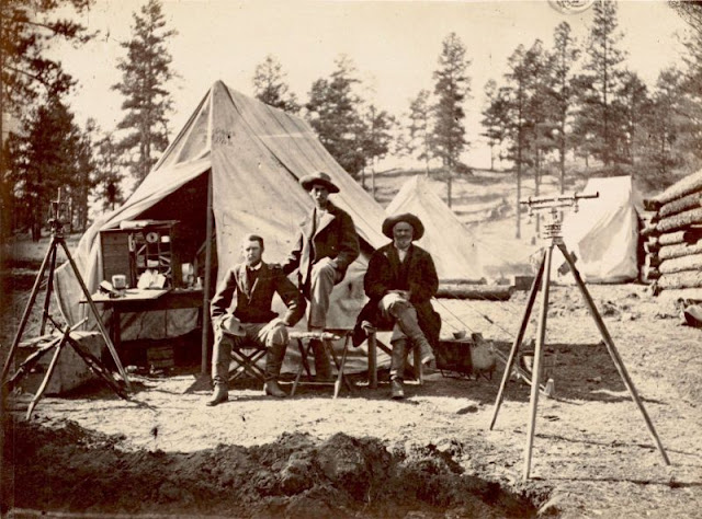
| Camp of surveying party at Russell's Tank, Arizona, on eastern slope of Laja Range, 1,271 miles from Missouri River, 1867 |
 |
| Crossing of the Line at Tecalote Creek, New Mexico, north of Anton Chico, 775 miles west of Missouri River, 1867 |
 |
| Crossing of the Republican, in Kansas, 136 miles west of Missouri River, 1867 |
 |
| Engineer camp at the Zuni Pass, in the Sierra Madre, New Mexico, 975 miles west of Missouri River, 1867 |
 |
| Falls of the Tecalote, New Mexico, in the foot hills of the Rocky Mountains, 775 miles west of Missouri River, 1867 |
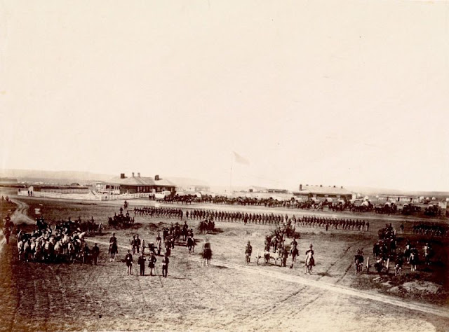 |
| Fort Harker, Kansas, 218 miles west of Missouri River, 1867 |
 |
| Indian farm at Stranger, Kansas, 1867 |
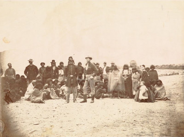 |
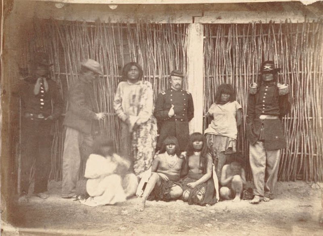
| Indians at Fort Mojave, Arizona, Sicihoot, War Chief of the Mojaves, circa 1867 |
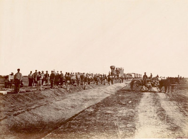 |
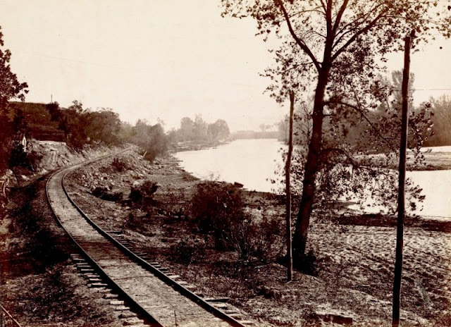
| Laying track, 300 miles west of Missouri River, October 19, 1867 |
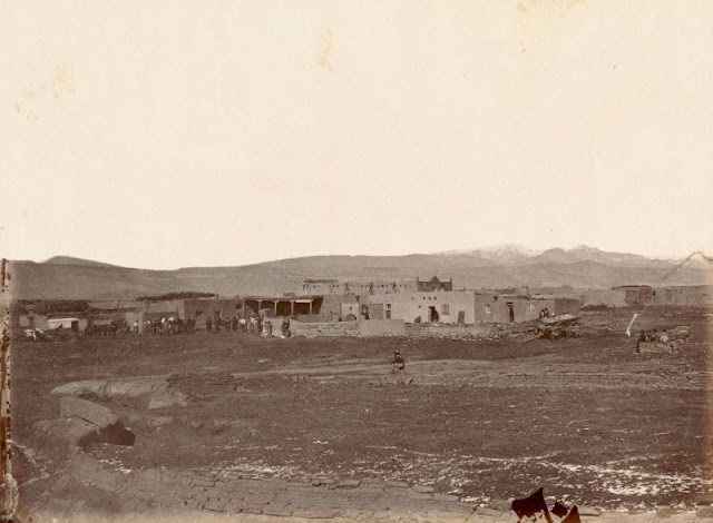 |
| Mexican town of Cubero, New Mexico, Western Outpost on 35th Parallel, 935 miles west of Missouri River, 1867 |
 |
| Mojave Indians, on the Colorado, Arizona, circa 1867 |
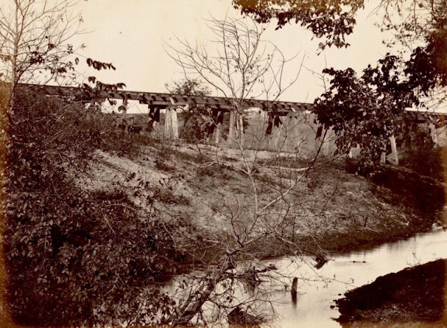 |
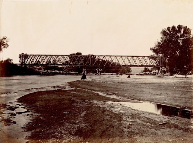
| Muddy Creek Bridge, Kansas, 162 miles west of Missouri River, 1867 |
 |
| Mushroom Rock on Alum Creek, Kansas, 211 miles west of Missouri River, 1867 |
 |
| New Mexican Ranche on the Rio Grande, below Albuquerque, 1867 |
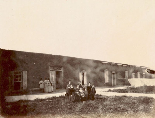 |
| New Mexican Ranche on the Rio Grande, below Albuquerque, 1867 |
 |
| On the Rio Grande, between Albuquerque and Fort Craig, 1867 |
 |
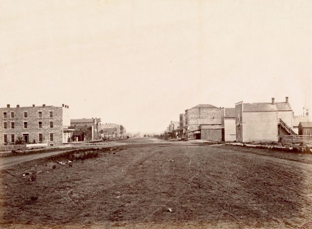
| Overlooking Lawrence and the Kansas River, 1867 |
 |
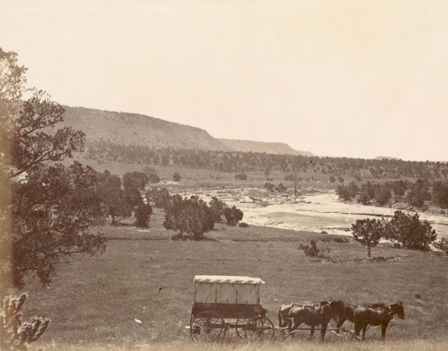
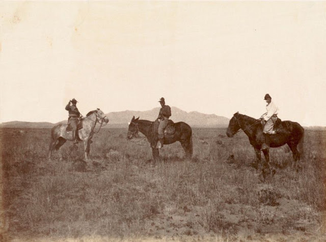
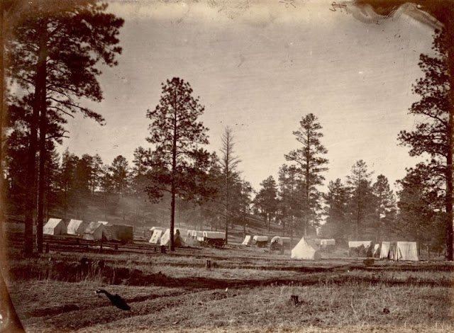
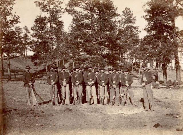
| Runk's Division of the Engineer Corps on the Plains, 1867 |
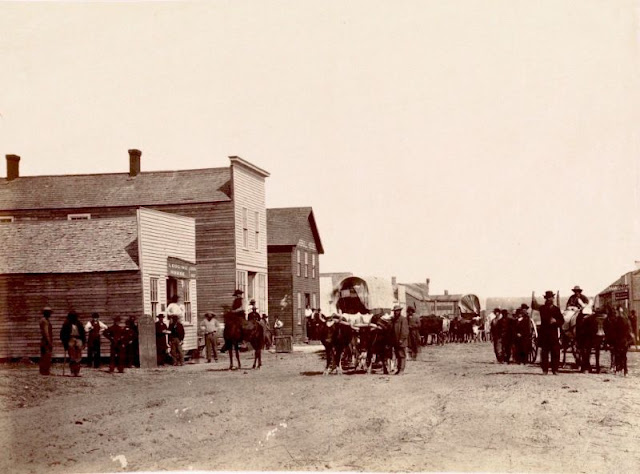 |
| Santa Fe Train passing through Ellsworth, Kansas, 1867 |
 |
| Shipping Point for Texan Cattle, Abilene, Kansas, 162 miles west of Missouri River, 1867 |
 |
| Sinks of Tehachapa, California, 1867 |
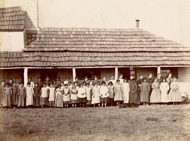 |
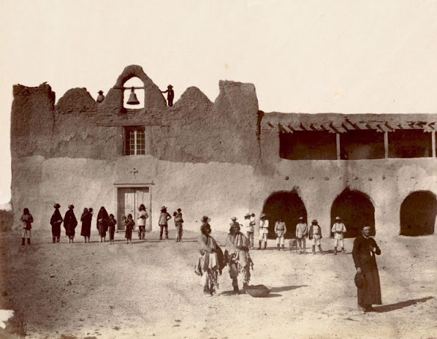
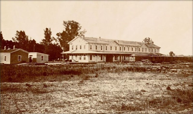
| St. Mary's Mission, Kansas, Pottawatomie Indian School, 90 miles west of Missouri River, 1867 |
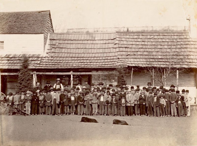 |
| St. Mary's Mission, Kansas, Pottawatomie Indian School, 90 miles west of Missouri River, 1867 |
 |
| St. Mary's Mission, Kansas, Pottawatomie Indian School, 90 miles west of Missouri River, 1867 |
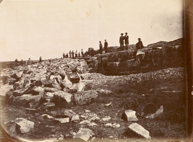 |
| Stone Quarry at Fort Lyon, Southern Colorado, 525 miles from Missouri River, 1867 |
 |
| Surveying Party at Agua Frio, in Sierra Madre, New Mexico, (The Water Shed of the Continent), 970 miles west of Missouri River, 1867 |
 |
| The State Line Union Depot - between Kansas and Missouri, near Kansas City, on the Kaw by the MO River - 275 miles West of St. Louis, Missouri, 1867 |
 |
| The two races, at Fort Mojave, Arizona, circa 1867 |
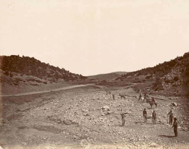 |
| Tijeras Canyon, New Mexico, in the Great Organ Range descending westward to the Rio Grande, 850 miles west of Missouri River, 1867 |
 |
| Topeka, Capital of Kansas, 68 miles west of Missouri River, 1867 |
 |
| Union Pacific Railway, Eastern Division, Saint Louis, Missouri, the Kansas Pacific Railroad - Depot 511 - 7th St. and Washington, 1867 |
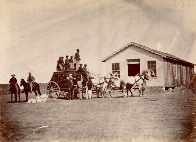 |
| United States Overland Stage starting for Denver from Hays City, 289 miles west of Missouri River, 1867 |
 |
| View near Fort Harker, Kansas, 216 miles west of Missouri River, 1867 |
 |
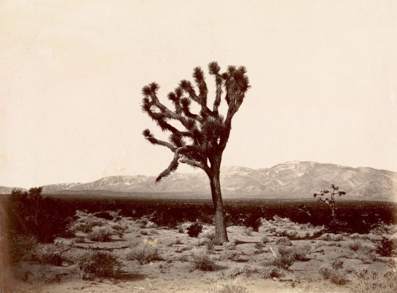
| Yucca tree, ‘Spanish Bayonet’, on the Great Basin, Southern California; Sierra Nevada in the distance, 1670 miles from Missouri, circa 1867 |
 |
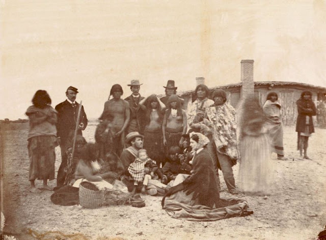
| Zuni Indians, near border of New Mexico and Arizona, 1867 |
 |
| Zuni Pass, New Mexico, summit of Sierra Madre, (Water Shed of Continent), 980 miles west of Missouri River, November 1867 |


0 comments:
Post a Comment