The Blue Mountains are a mountainous region and a mountain range located in New South Wales, Australia. The region borders on Sydney's metropolitan area, its foothills starting about 50 kilometres (31 mi) west of centre of the state capital, close to Penrith on the outskirts of Greater Sydney region.
As defined in 1970, the Blue Mountains region is bounded by the Nepean and Hawkesbury rivers in the east, the Coxs River and Lake Burragorang to the west and south, and the Wolgan and Colo rivers to the north. Geologically, it is situated in the central parts of the Sydney Basin.
The Blue Mountains Range comprises a range of mountains, plateau escarpments extending off the Great Dividing Range about 4.8 kilometers (3.0 mi) northwest of Wolgan Gap in a generally southeasterly direction for about 96 kilometers (60 mi), terminating at Emu Plains. For about two-thirds of its length it is traversed by the Great Western Highway, the Main Western railway line and the soon to be completed, Blue Mountains tunnel. Several established towns are situated on its heights, including Katoomba, Blackheath, Mount Victoria, and Springwood. The range forms the watershed between Coxs River to the south and the Grose and Wolgan rivers to the north. The range contains the Explorer Range and the Bell Range.
The Blue Mountains area includes the local government area of the City of Blue Mountains. The Blue Mountains and Southern Highlands Basalt Forests is a prominent forest community within the ecoregion. Here is a set of fascinating photos from
Powerhouse Museum that shows what Blue Mountains looked like around 1900.
 |
| A Lookout, Katoomba, New South Wales, circa 1900 |
 |
| Blue Mountains Scenery, Wentworth Falls, New South Wales, circa 1900 |
 |
| Breakfast Point, Wentworth, New South Wales, circa 1900 |
 |
| Bridal Falls, Leura, New South Wales, circa 1900 |
 |
| Caves House, Jenolan Caves, New South Wales, circa 1900 |
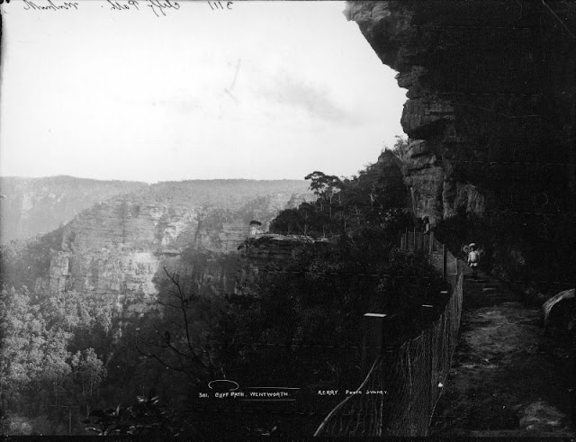 |
| Cliff Path, Wentworth, New South Wales, circa 1900 |
 |
| Copeland's Lookout, New South Wales, circa 1900 |
 |
| Grose Valley from Breakfast Point, Blackheath, New South Wales, circa 1900 |
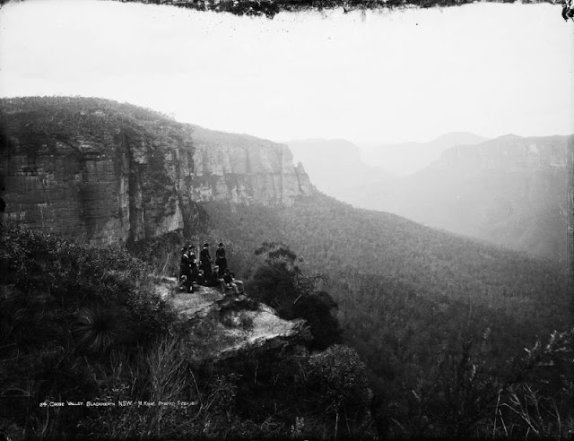 |
| Grose Valley, Blackheath, New South Wales, circa 1900 |
 |
| Jamieson Valley, New South Wales, circa 1900 |
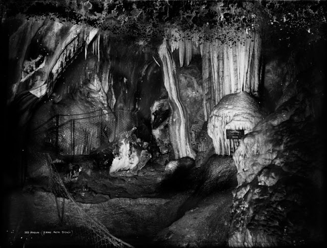 |
| Jenolan Caves, New South Wales, circa 1900 |
 |
| Katoomba Falls, New South Wales, circa 1900 |
 |
| Katoomba Railway Station, New South Wales, circa 1900 |
 |
| Kinnimbla Valley from Katoomba, New South Wales, circa 1900 |
 |
| Lodore Fall, Blue Mountains, New South Wales, circa 1900 |
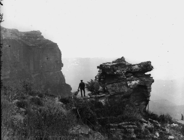 |
| On the Narrow Neck, Katoomba, New South Wales, circa 1900 |
 |
| Orphan Rock, Katoomba, New South Wales, circa 1900 |
 |
| Outlook, Prince Regent's Glen, Wentworth Falls, New South Wales, circa 1900 |
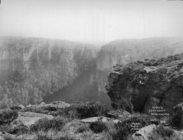 |
| Perry's Lookdown, Blackheath, New South Wales, circa 1900 |
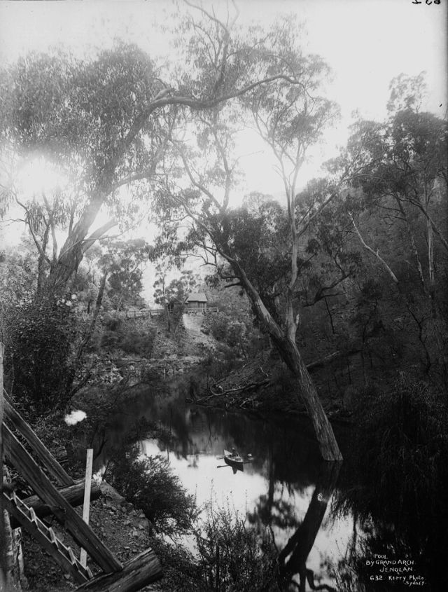 |
| Pool by Grand Arch, Jenolan Caves, New South Wales, circa 1900 |
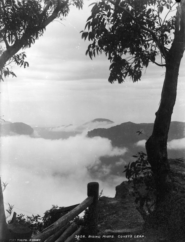 |
| Rising Mists, Govetts Leap, New South Wales, circa 1900 |
 |
| Rising Mists, Wentworth, New South Wales, circa 1900 |
 |
| Road to Wentworth Falls, New South Wales, circa 1900 |
 |
| Stalacmite Cave, Right Imperial Cave, Jenolan Caves, New South Wales, circa 1900 |
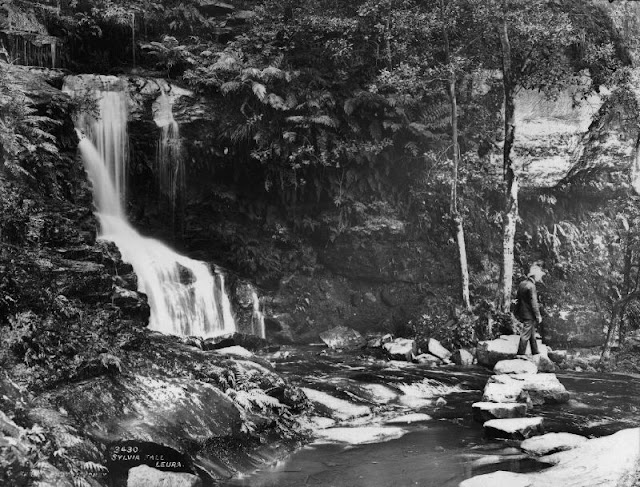 |
| Sylvia Falls, Leura, New South Wales, circa 1900 |
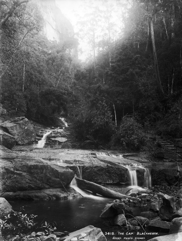 |
| The Gap, Blackheath, New South Wales, circa 1900 |
 |
| The Glen, Katoomba, New South Wales, circa 1900 |
 |
| The Three Sisters, Katoomba, Blue Mountains, New South Wales, circa 1900 |
 |
| Weeping Rock, Wentworth Falls, New South Wales, circa 1900 |
 |
| Zig Zag Railway, New South Wales, circa 1900 |


0 comments:
Post a Comment