New Zealand is a sovereign island country in the southwestern Pacific Ocean. The country has two main landmasses—the North Island, and the South Island—and around 600 smaller islands. It has a total land area of 268,000 square kilometres (103,500 sq mi).
New Zealand is about 2,000 kilometres (1,200 mi) east of Australia across the Tasman Sea and 1,000 kilometres (600 mi) south of the Pacific island areas of New Caledonia, Fiji, and Tonga. Because of its remoteness, it was the last large habitable land to be settled by humans.
The country's varied topography and its sharp mountain peaks, such as the Southern Alps, owe much to the tectonic uplift of land and volcanic eruptions. New Zealand's capital city is Wellington, and its most populous city is Auckland.
A developed country, New Zealand ranks highly in international comparisons of national performance, such as quality of life, health, education, protection of civil liberties, and economic freedom.
Take a look at these fascinating color photos from Custardesque to see what life of New Zealand looked like in the 1960s.
 |
| Southland. Lumsden |
 |
| Akaroa. Children at dock |
 |
| Auckland Harbour Bridge |
 |
| Blenheim. In front of the Chief Post Office |
 |
| Bluff. MV Waiwera |
 |
| Borgward Isabella coupe at Wellington Airport |
 |
| Bridgman Street with the Drill Hall buildings on the right |
 |
| Bridgman Street, approaching Andersons Bay Road |
 |
| Cascade Lodge, Milford road |
 |
| Christchurch. Bridge of Remembrance |
 |
| Christchurch. Cathedral Square |
 |
| Dunedin Botanic Garden. Daffodil lawn |
 |
| Dunedin Railway Station |
 |
| Dunedin. HMNZS Otago |
 |
| Girl with cats |
 |
| Hastings. Heretaunga Street East and Karamu Road, showing the Albert Hotel (demolished 2014) |
 |
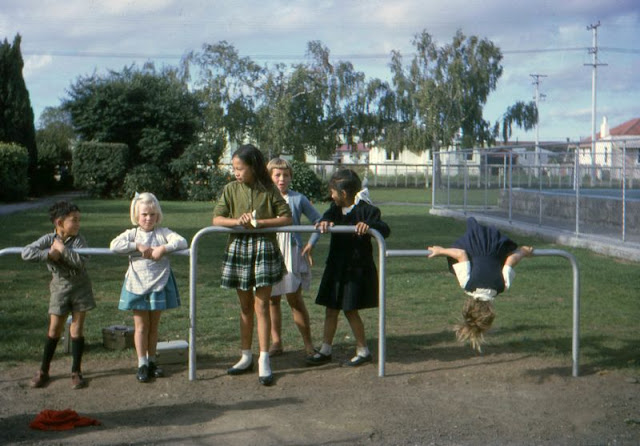
| Marton Junction School |
 |
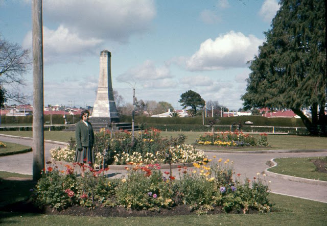
| Marton Park and war memorial |
 |
| Marton. Marton Junction children stop on the bridge on the return to school |
 |
| Marton. Road safety at Marton Junction School |
 |
| Milford Track. Boatshed Hut |
 |
| Milford Track. Sandfly Point |
 |
| Morris Minor 1000, probably southern Westland, South Island |
 |
| On a New Zealand beach |
 |
| Pukaki children |
 |
| Rotorua. Bath house |
 |
| Roxburgh with Austin A40 Farina and Mark II Jaguar |
 |
| Roxburgh. Bank of New Zealand |
 |
| Stewart Island. Halfmoon Bay with the Tourist Air Travel Ltd Grumman G-44A Widgeon aircraft ZK-BAY |
 |
| Turakina. Sword dancing |
 |
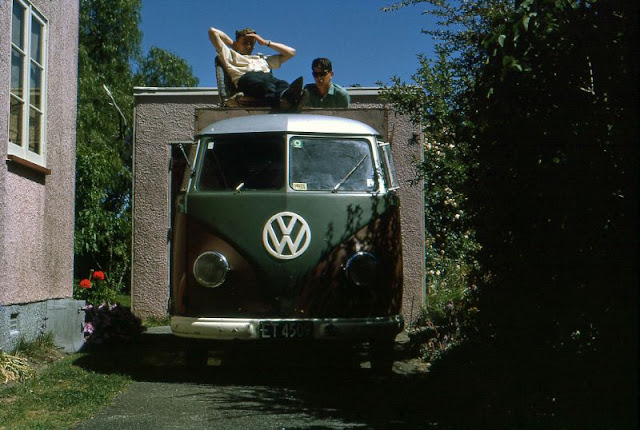
| VW Kombi |
 |
| Wellington Botanic Garden |
 |
| Wellington cable car |
 |
| Wellington from Molesworth Street |
 |
| Wellington from Rama Crescent, Khandallah |
 |
| Wellington harbour view |
 |
| Wellington. Kelburn Normal School jubilee |
 |
| Wellington. Lambton Quay with the MLC Building |
 |
| Wellington. Lambton Quay |
 |
| West Coast. Franz Josef tearooms and store |


Some of those places haven't changed much! ;-)
ReplyDeleteI don't know about today, but not much different from when I visited those places in the '90s.
ReplyDeleteIt probably would have been simply polite to ask the owner of the collection first, before taking them off Flickr and making a feature out of them.
ReplyDeleteBrilliant - thanks for the AWE!
ReplyDelete